In which I almost got lost in the Chilean bus system, then found my mountain again. It came with strange green rocks, adorable foxes, and great trekking partners.
“We passed the day on the mountain’s summit, and never has time seemed shorter to me. Chile extends at our feet like an immense panorama limited by the Andes and the Pacific Ocean.” – Charles Darwin on La Campana
Few hills can offer as many views as Cerro La Campana, the ‘Bell Hill’. Its rocky summit looks west to the sea across Valaparaiso; south to Santiago, tucked in the misty Coastal Cordillera; and east into the Andes. Alongside its slightly tall partner, Cerro El Roble, it presides over a steep and ecologically diverse National Park. La Campana is one of the most dramatic day hikes available out of Santiago. However, hikers will have to be speedy to do it in time to catch the last bus home.
The trail rises by 1542m over 5.2km (non-drivers need to add an extra uphill kilometer from the nearest bus stop). Leisurely walkers can enjoy great views towards Valparaiso and the Cordillera de la Costa without summiting, however, or can camp overnight at the base of the trail and return in the morning. The best online route description is on Wikiexplora. I’ve posted a complete itinerary, with full details of public transport, at the bottom of this page.
Reaching the Parque Nacional
At about 8pm yesterday, I emailed six of my friends in Santiago to ask if they wanted to go climb La Campana. They all emailed back promptly to say that it was a great idea, then emailed again to say that I was absolutely crazy if I thought they’d all get up at six on a Saturday. I must have been crazy, because I did get up at six to catch the dawn bus to the mountain town of Olmue.
It was my first encounter with Chilean buses. Olmue is a two-hour drive northwest of Santiago, or forty minutes northeast of Valparaiso. I bought a return ticket, asked three ticket inspectors which bus stand was mine, and at caught my bus at 8:10. I saw that the bus had a little text-screen, assumed the driver would use it to announce the stops, and fell asleep. At 09:42 I woke up. All the nearby passengers were asleep. The little screen at the front of the bus blankly read ‘049km’.
Two stops went by, and two people went down past the driver and left the bus. I hadn’t a clue how they knew where they were. The windows were frosted white with condensation. I panicked, and at the next tiny stop I asked the driver, Cuantos minutos a Olmue? Plaza de Olmue? Siete, he replied. Just seven minutes? Back in my seat, I reached over my sleeping seatmate and rubbed the condensation from our window just in time to watch a tiny Olmue sign flash past. I got down at the next (and therefore westernmost) stop.
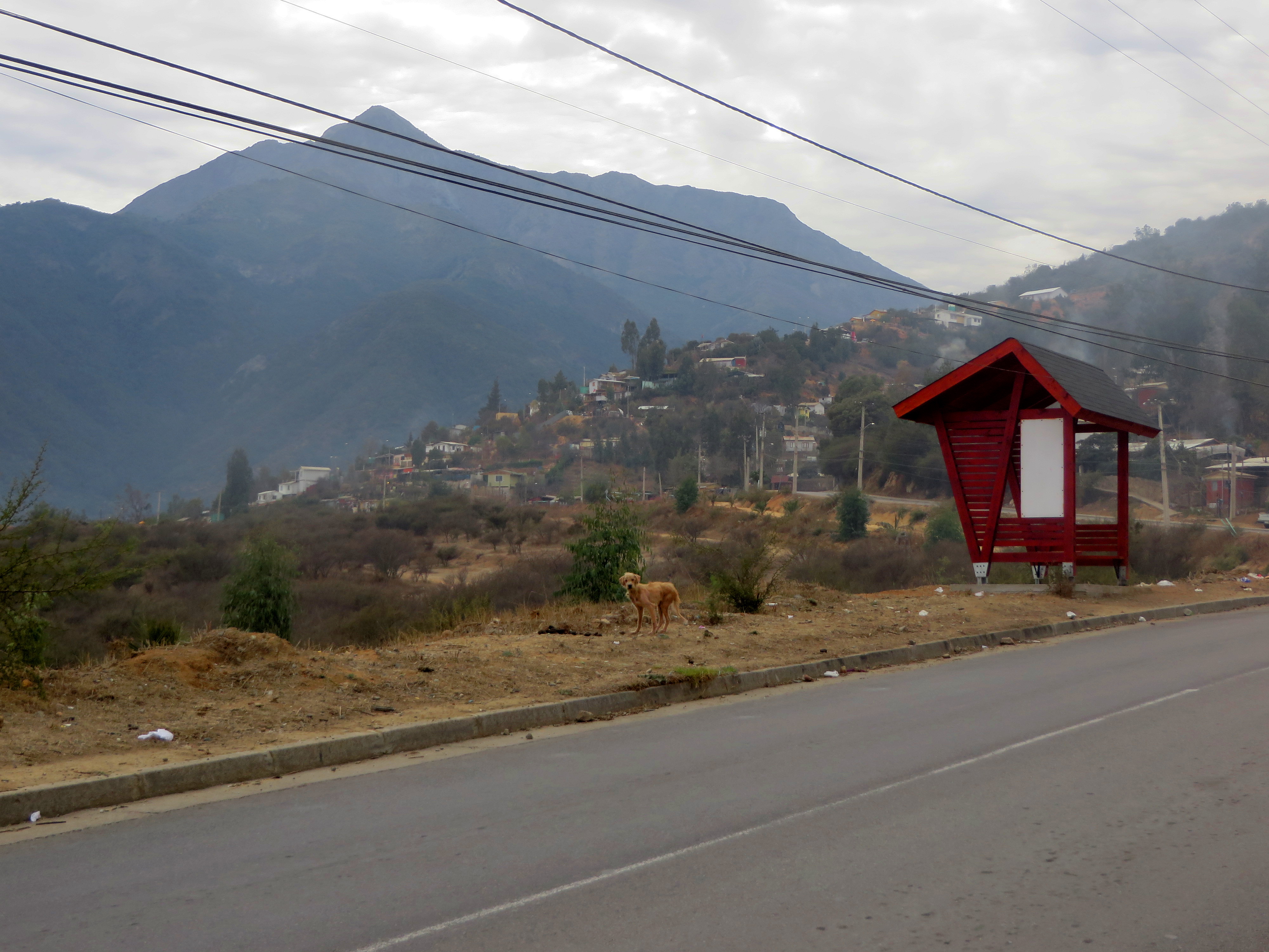
The bus disappeared behind me. The street signs around me had names not marked on my map. I gave myself fifty-fifty odds of being in the right town at all and started walking north. Olmue smells like smoke and dust, like stray dogs and meat cooking on an outdoor grill. Most of the buildings are about the size of my Santiago apartment, or a suburban American living room. Everything is brightly painted. And, of course, every part of the view is completely dominated by the mountains.
To find La Campana without a map, just pick the highest point on the horizon and walk towards it. I stuck to major roads (knowing that I would have to find my way back to the bus stop) and got lucky. I reached the park entrance in just over an hour without backtracking once. The last section was a narrow winding road that turned from asphalt to rutted dirt without warming. An elderly man passed me as I was breaking a sweat on the hill. He had two walking sticks and a no-nonsense march that said, ‘I’ve done this hike every day for decades, and I’m faster on it than you’ll ever be.’
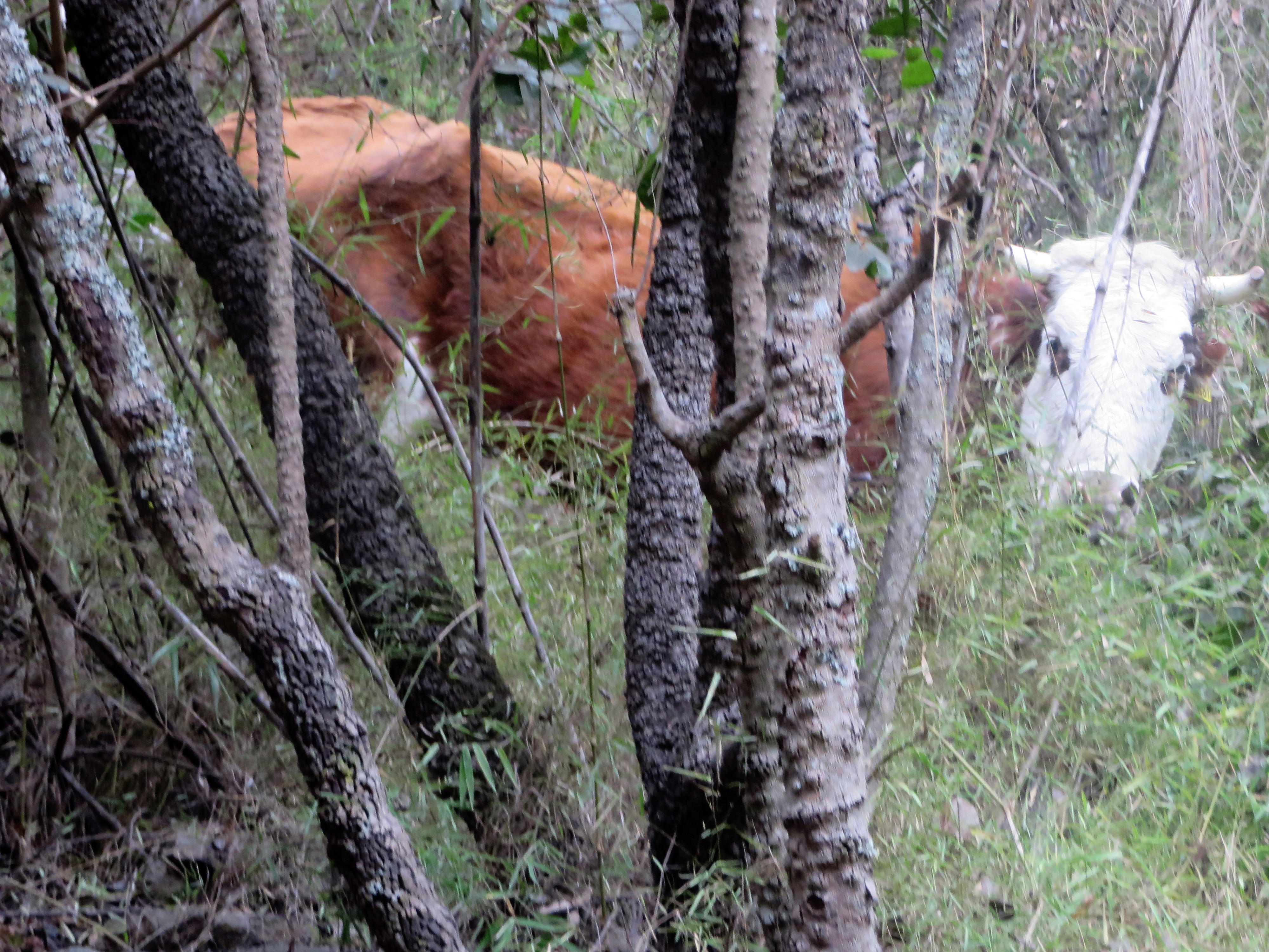
At the park control I paid my entrance fee and gained a map from the ranger, as well as a warning against trying for the summit in winter. This surprised me, as the 60◦F/15◦C temperature would be considered perfect hiking weather in the northeast US. (Note: most of the trail is fine, but the summit is a pile of loose rock completely exposed to the wind. I would not have attempted it alone.) Not a quarter mile up the trail, I stopped short. Animals in the bushes. Two large animals. I clapped my hands so I wouldn’t surprise anything. A pair of cows peered out at me, then went back to chewing leaves.
For the next few kilometres, the trail switch-backed up the 50◦ slope below the cumbre. Every so often we passed old landslide scars, and sometimes not-so-old ones where the trail simply ended in empty air and a signpost pointing towards a detour. The country rock here, where it’s exposed by the landslides, is fine-grained and dark. Volcanic. Periodically the trail passed huge, suspiciously fresh-looking boulders, presumably the remnants of landslides and rockfalls from the slopes above.
The mystery mineral of La Mina
A few boulders along the trail had a greenish tinge. Translucent green crystals, no more than one millimetre across, interlocked with resinous grey crystals.
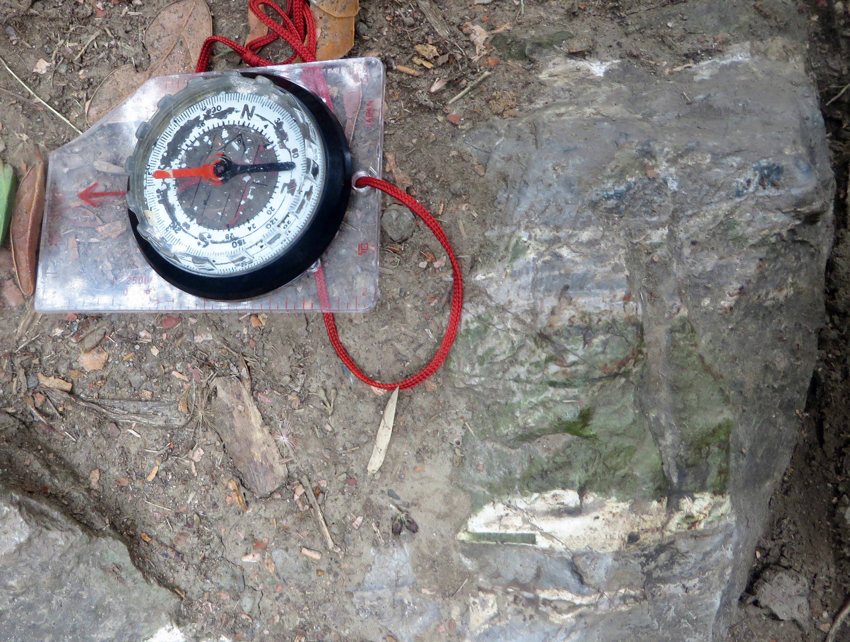
Fun fact: the ‘N’ on my compass points to magnetic north. The red pointer doesn’t. The green rock is deflecting the magnet. The grey country rock doesn’t do this. The most strongly magnetic minerals, such as hematite and magnetite, are iron and titanium oxides. A kilometre higher up, the trail passed three old mine entrances. Clearly someone had found value in the rocks here.
I used my camera flash to look inside, and found an abundance of green. Unfortunately, the floor was too steep for me to get closer without risking a fall. What is being mined here?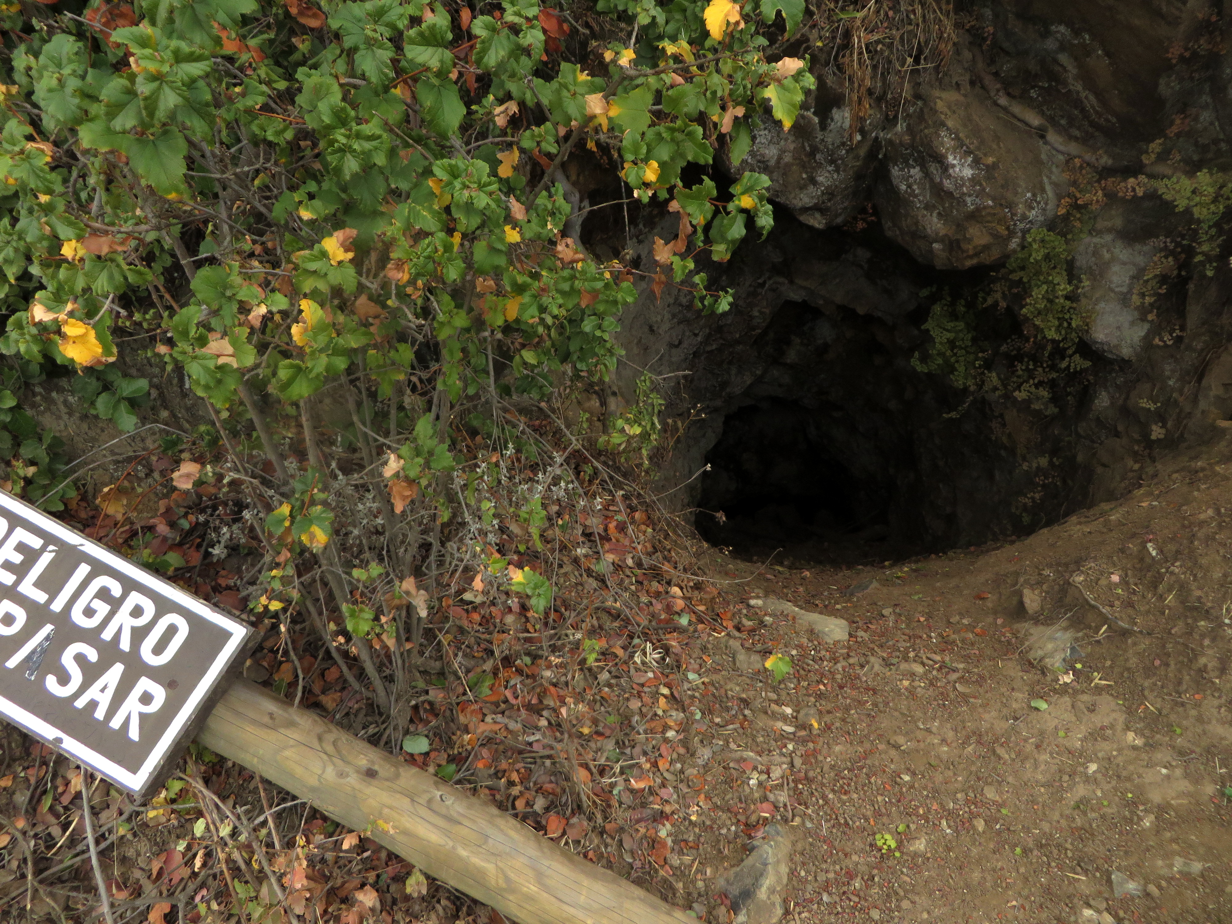
According to the government’s geological maps, La Campana is part of a 85-123 million-year-old igneous formation (‘Kiag’ on the map legend p.14). This formation stretches along the Coastal Cordillera as far north as the Atacama Region, where it is mined for iron. In the Valparaiso region around La Campana it contains copper and gold.
My best guess is that the green is an alteration mineral. When hot fluids move through igneous rock, their reactions often produce a family of minerals known as ‘serpentine’. One of the most common of these is lizardite, named for its bright green color. Lizardite can contain iron or magnetite inclusions, either of which might have disturbed my compass. The fluids which create serpentine often deposit a range of other minerals, including valuable metal ores.
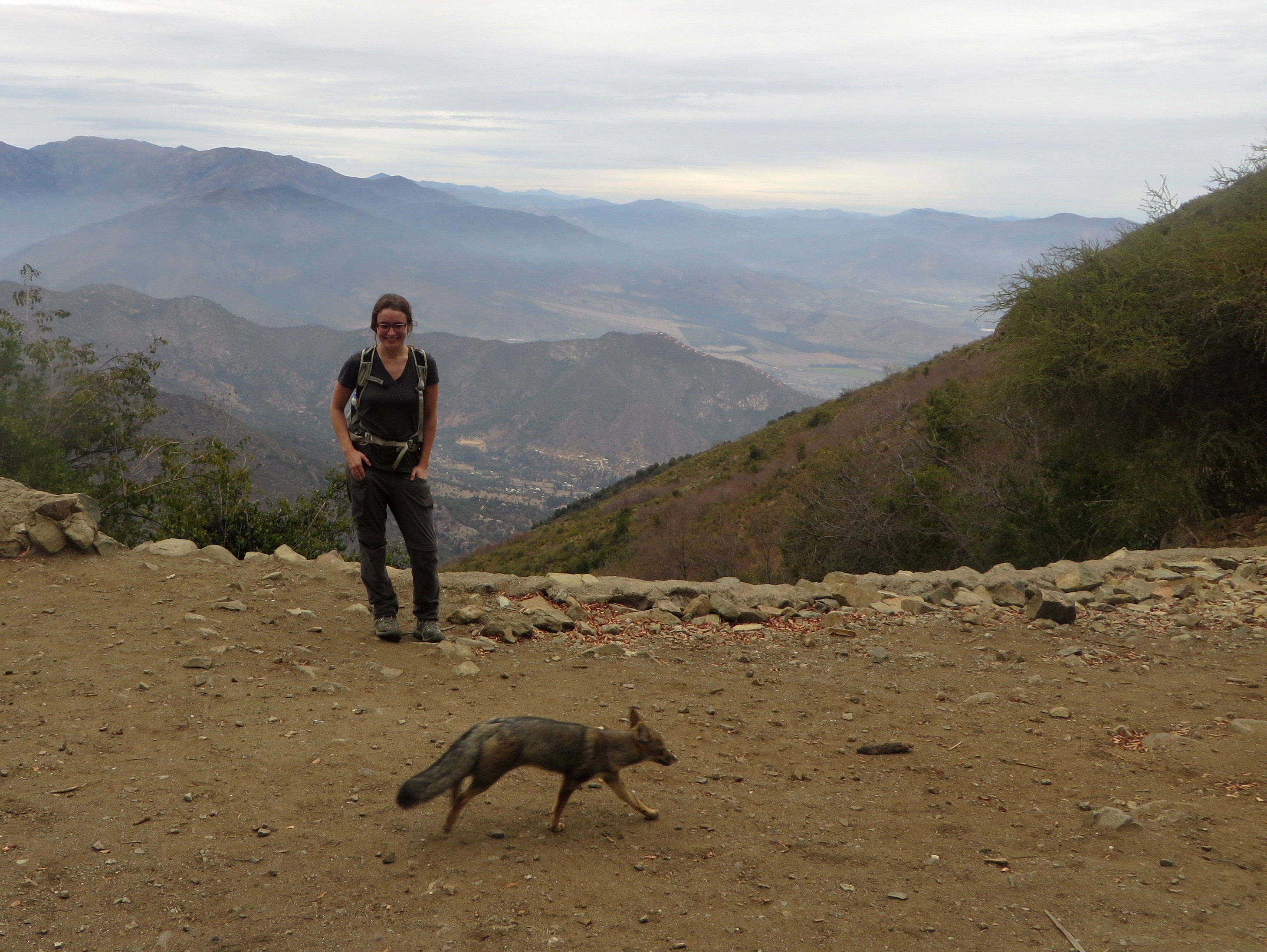
The next area on the hike was called La Mina, or ‘The Mine’. La Mina is the largest mine entrance; the highest point on the hike accessible by horse or vehicle; and the home of loud little foxes called zorros. I think their barks evolved to carry back and forth between mountain ranges.
Zorros on the Cerros : Foxes on the hills
I sat to drink my tea and watch the view. The zorros were yelping shrilly and running circles around two young men who swivelled around the platform trying to catch them on camera. The pair had passed me at my lunch spot half a kilometre lower down, where they had greeted me cheerfully in incomprehensible rapid-fire Spanish. Now they called to me again. Hm? I tilted my head in confusion. They called again with gestures. Did I want them to take a photo of me with the zorros?
They ask if I’m continuing to the summit. I check my watch. It’s 13:45. Climbing alone I planned to be down by 17:30, well before dark and the last bus. With partners I could stretch that a little further. ¿Tienen luz? I ask. Sí, they reply. They have lights. I tell them I can continue if we’re fast and if it doesn’t rain.
Their are Álvaro and Salvador. They’re both studying engineering in the nearby city of Valparaíso. They are jealous of U.S. education because our degrees only take four years, and Salvador doesn’t expect to finish his in less than eight. We pass the rest of the hike in pleasant conversation.
The top of La Campana
These mountains are young and jagged. Unlike its bell-like namesake, the top of La Campana is even steeper than its lower slopes. The last kilometre of the trial is covered in loose, jagged blocks of diorite rock lying at slopes steeper than 45◦. That’s the easy approach. The north and south faces are both near-vertical, and in many places overhung. From here, it’s clear that rock must periodically crack off the bare summit and roll down the valley we just climbed. No wonder we passed so many huge boulders. The nearby summit of El Roble is even more deeply scarred.
The peak is always further than it looks. It was an hour and a half before
I stumbled onto the last ridge, breathing hard. Wow. The Cordillera stretched on in front of me into a pink stripe of sunset sky. This isn’t just one mountain after another. It’s one cordillera after another. To the east, the snowy flanks of the Andes appear as distant flashes of white below the clouds. The wind is freezing. I could stand here forever.
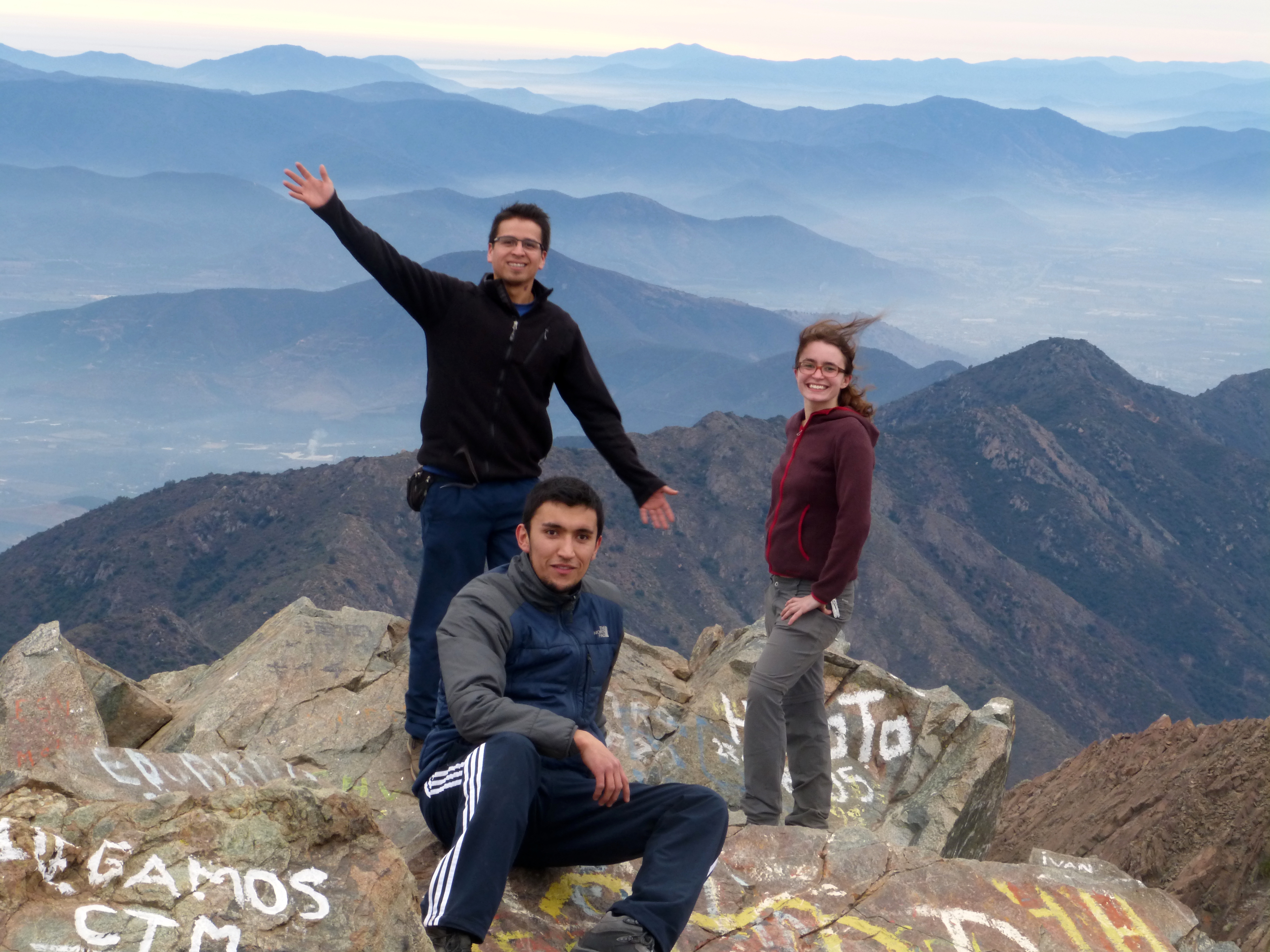
Summit photo credit : Álvaro Páez
Full itinerary:
Here is everything I knew heading out, plus a few useful things I discovered along the way.
The cost of the trip (transport and park entry fee) was CL$10.000. The camping fee is CL$6.000 for up to six people.
La Campana as a day trip from Santiago
06:55 – Buy a return ticket to Olmue (CL$6000) at the Alameda bus terminal. The terminal is right outside the Universidad de Santiago metro stop. The full bus schedule is here.
07:10 – Bus leaves for Olmue. Bus stops may not be announced, so watch the streetsigns closely as you approach the expected arrival time. There are several stops in Olmue. You want the first.
08:50 – Bus arrives at the Plaza de Olmue.
Towards the Parque Nacional La Campana: Walking (1 hour): The road Hugo Quinteras begins at the Plaza. Follow it north. It will eventually end in a T-junction. Turn right and continue on Granizo. Ignore signs for the park’s other entrance, ‘Cajon Grande’. The road ends at a large Parque Nacional sign for the ‘cumfre’ or summit.
Buses: Local buses, painted green and yellow, run along this route. If you catch one, ask for ‘Cumfre La Campana’ or ‘La Campana, Granizo’. The fee is CL$300. Your stop is the end of the line. The bus takes about twenty minutes.
Parque Nacional La Campana: Once you reach the Parque Nacional sign by foot or by bus, you will need to walk one more kilometre up a winding road to reach the park headquarters. There you must sign in with the ranger and pay an entrance fee of up to CL$2500 for a foreign adult. He has paper maps.
The summit trail is sendero Andalista. It’s well-marked.
15:00 – Suggested turn-around time to catch the bus back to Santiago.
20:05 – Arrive at Pullman bus stop at the Plaza de Olmue or the Pullman bus terminal in Olmue. If getting back by bus, make sure you ask the driver to put you off at the right stop.
20:20 – Scheduled departure time for the last bus to Santiago. The bus may be early.
22:10 – Bus arrives at the Alameda terminal in Santiago. This is its last stop.
Aubrey
Admired the adventure, Beautiful mountain!